Application Description:
Tiled Map Editor for 2D Games
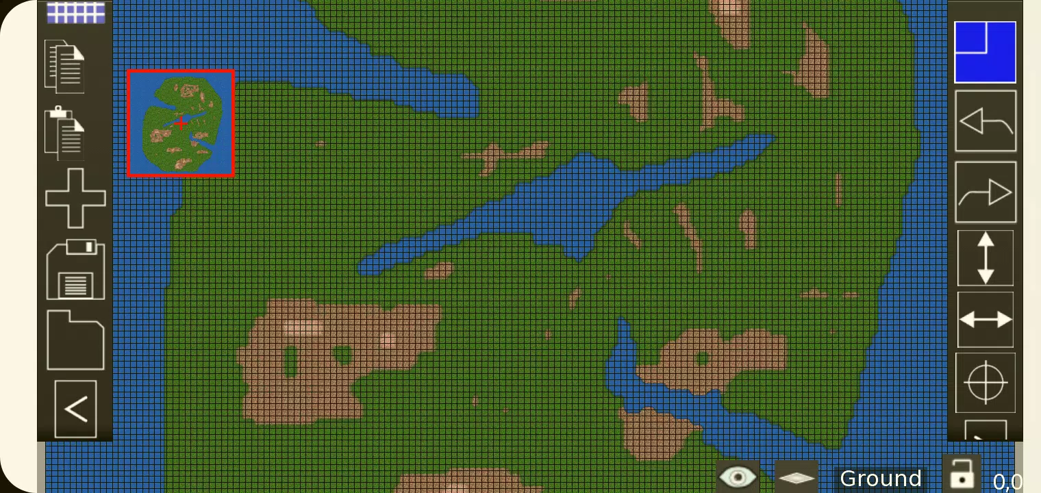
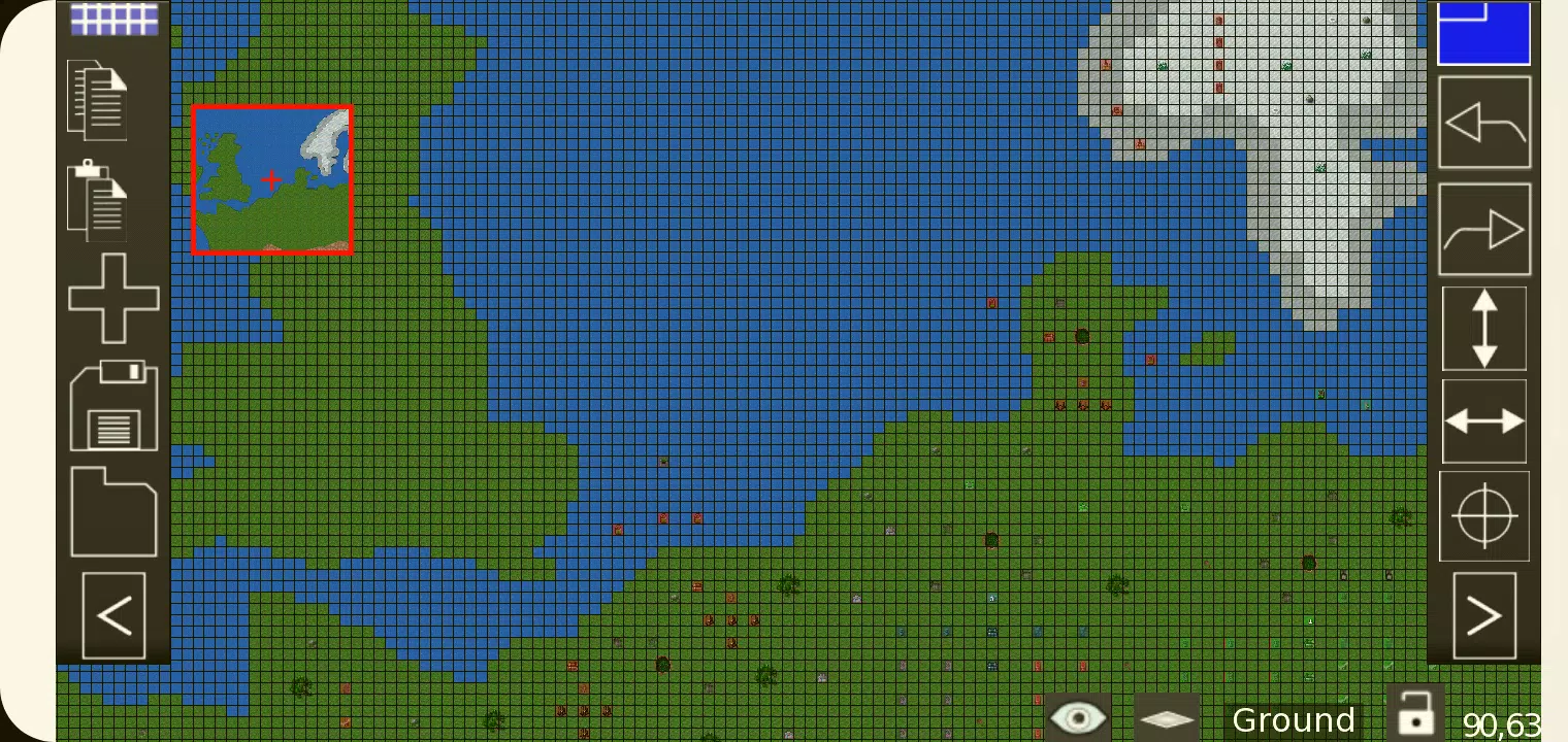
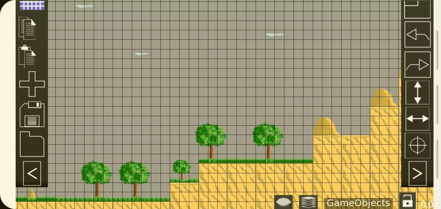
TMEditor is a powerful, free tool designed to simplify the creation of map layouts for 2D games. It's not just about placing tiles; TMEditor's versatility extends to defining abstract elements such as collision areas, enemy spawn points, and power-up locations. All this data is conveniently saved in the standardized .tmx format, ensuring compatibility and ease of use.
How Does TMEditor Work?
The process of creating maps with TMEditor is straightforward and efficient, following these steps:
- Choose your map size and base tile size to set the foundation of your game world.
- Add tilesets from image(s) to provide the visual elements for your map.
- Place the tilesets on the map to build the layout.
- Add any additional objects to represent abstract concepts like collision areas or spawn points.
- Save the map as a .tmx file for easy storage and retrieval.
- Import the .tmx file and interpret it for seamless integration into your game.
Features
- Orientation Options: Supports both orthogonal and isometric orientations for varied map designs.
- Tileset Management: Allows for the use of multiple tilesets to enhance map diversity.
- Object Layers: Incorporates multiple object layers for comprehensive map detailing.
- Multi-layer Editing: Offers eight layers, enabling you to add intricate details to your maps.
- Custom Properties: Assign custom properties to maps, layers, and objects for tailored gameplay mechanics.
- Editing Tools: Equipped with tools like Stamp, Rectangle, and Copy Paste for efficient map editing.
- Tile Manipulation: Features tile flipping for varied tile placement.
- Undo/Redo Functionality: Currently supports undo and redo for tile and object mapping, ensuring mistake-free design.
- Object Types: Supports a wide range of objects including rectangles, ellipses, points, polygons, polylines, text, and images.
- Isometric Object Placement: Allows for the placement of objects on isometric maps.
- Background Image: Option to include a background image to enhance the visual appeal of your map.
- Export Options: Offers various export formats such as XML, CSV, Base64, Base64-Gzip, Base64-Zlib, PNG, and Replica Island (level.bin) for versatile integration.
What's New in the Latest Version 1.0.27
Last updated on Oct 4, 2024, this version focuses on bug fixes to ensure a smoother and more reliable user experience.
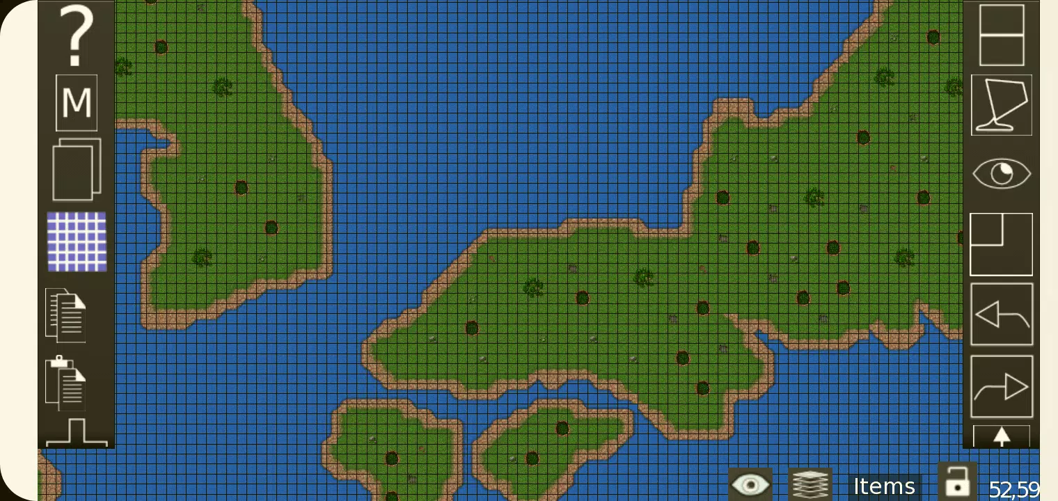
Screenshot
App Information
Version:
1.0.27
Size:
5.4 MB
OS:
Android 10.0+
Developer:
Microspace Games
Package Name
com.microspacegames.app.android
Available on
Google Pay
Reviews
Post Comments


Trending apps


Software Ranking