Effortlessly manage your KML/KMZ/GPX files with MAPinr, the ultimate GIS tool designed for ease of use. Whether you're measuring distances, logging GPS data, or utilizing WMS for map services, MAPinr offers a comprehensive solution. Plus, enjoy the convenience of offline maps, perfect for when you're off the grid.
Thank you for choosing MAPinr. As Android versions evolve rapidly, it's challenging for non-profit projects like ours to keep up. However, our commitment to providing a secure, privacy-friendly, and affordable app remains steadfast. We understand that some devices may not support the minimum Android version required by Google. That's why we offer downloads for Android versions below 14 on our website, ensuring everyone can access our app.
Are you looking to manage your points of interest or place your pictures on a map? MAPinr is the perfect ad-free Android app for you. It's ideal for professionals and enthusiasts alike, whether you're into hiking, cycling, running, skiing, or any other outdoor activity.
We value your feedback and ideas for improving MAPinr. Please share your thoughts and suggestions via email at [email protected]. We appreciate your understanding and patience, as our limited resources mean we can't implement every suggestion immediately.
MAPinr offers a wide range of features, including:
- Ad-Free Experience: Enjoy an app free from intrusive ads.
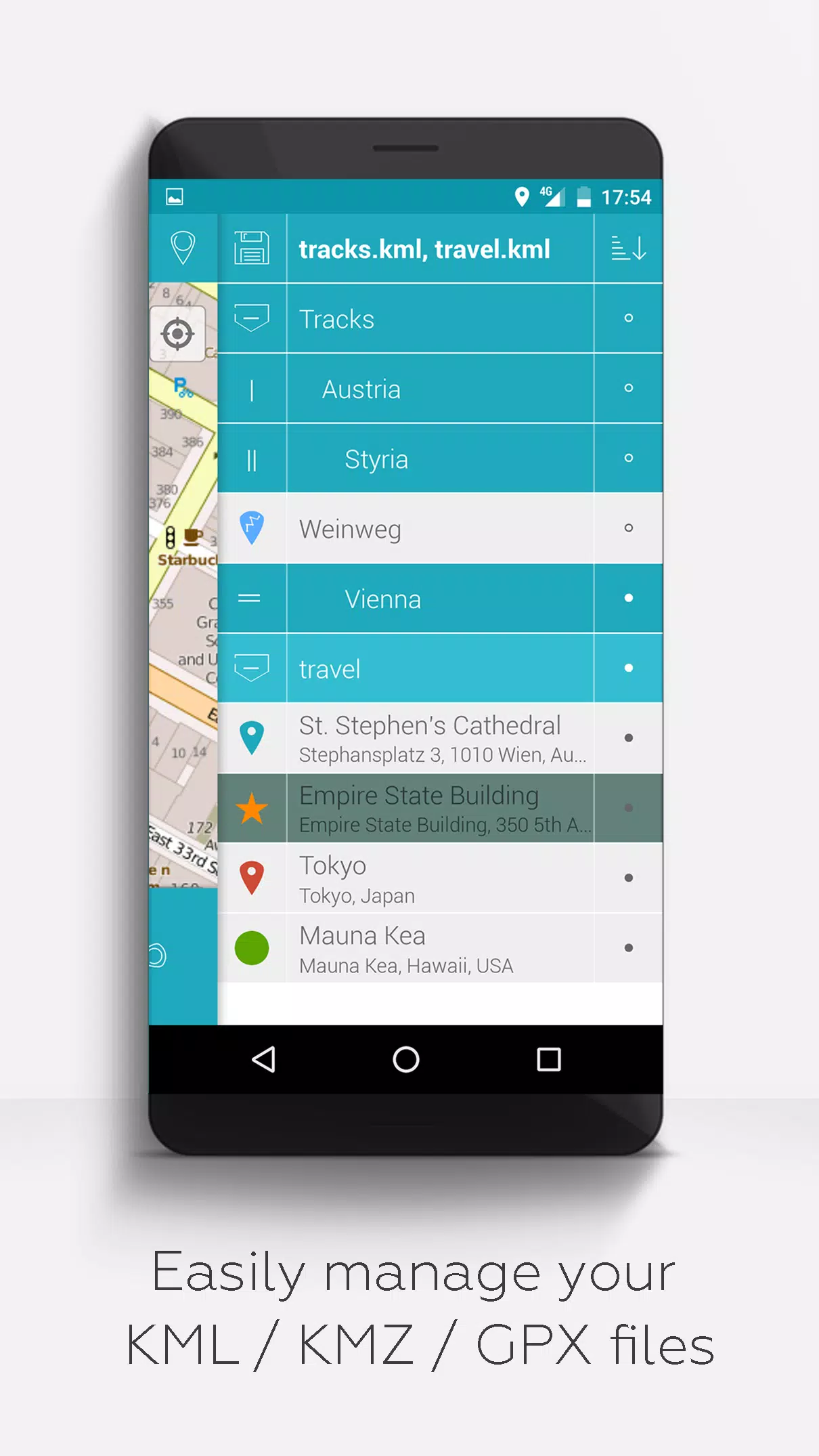
- Hierarchical Folder Structure: Easily manage multiple KML/KMZ/GPX files.
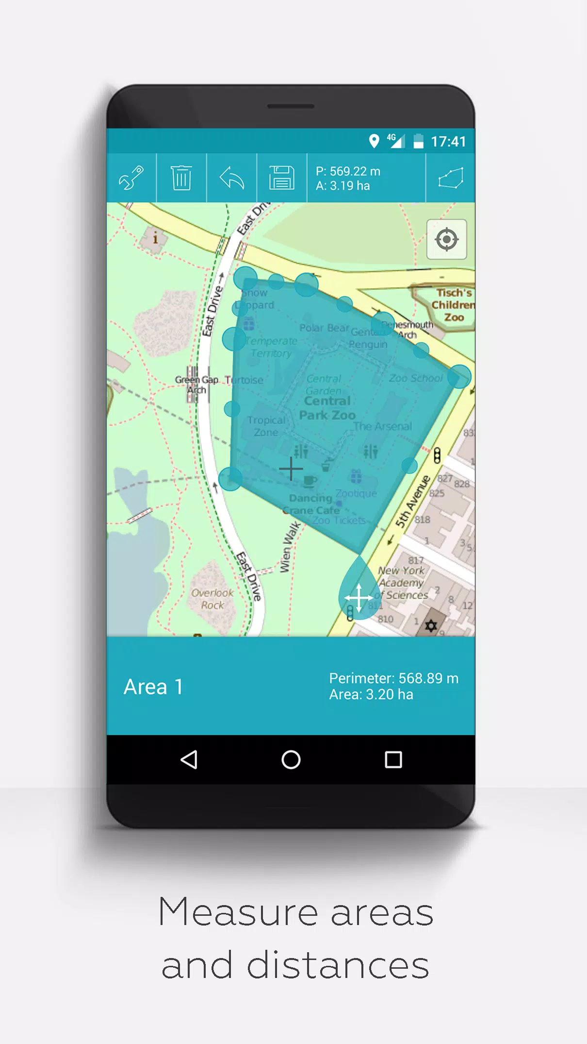
- Comprehensive File Management: Create, load, edit, save, import, export, and share KML/KMZ files.
- Waypoint, Line/Track, and Polygon Management: Create, load, edit, save, import, export, and share these elements.
- Photomaps: Add pictures to your waypoints to create personalized maps.
- Versatile Map Display: View your data on various maps, including Maps, Satellite, Hybrid, OpenStreetMap, Opentopomap, and Opencyclemap.
- Coordinate Sharing: Share the coordinates of your waypoints with others.
- Custom Colorization: Individualize the colors of your waypoints, lines/tracks, and polygons.
- Inter-App Compatibility: Open exported KML/KMZ files in other apps.
- Advanced Search: Search by name, address, and coordinates.
- Location Sharing: Let your friends know where you are in real-time.
- Simultaneous Display: View multiple KML/KMZ/GPX files at once.
- File Merging: Merge KML/KMZ files for streamlined management.
- Cloud Integration: Sync your data seamlessly with cloud services.
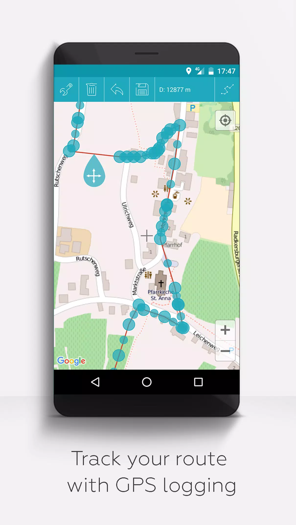
- Measurement Tools: Measure distances and areas directly on the map.
- Multilingual Support: Available in English, Spanish, Lithuanian, and Polish.
For those who contribute through donations or show support on LinkedIn, we offer extended features that can be activated in the settings:
- Offline Maps: Download OpenStreetMap data for free.
- GPX Viewer: Display your GPX files.
- Web Map Service (WMS): Access arbitrary map data, such as from www.data.gov.
- Custom Metadata: Create tailored metadata for your needs.
- Custom Icons: Upload and use your own icons.
- GPS Track Recording: Log your journeys with GPS tracking.
Unlike other apps, MAPinr prioritizes your privacy and does not collect or sell your personal data. Your donations support our non-profit efforts to keep MAPinr a valuable tool for everyone.
4.1.2
76.3 MB
Android 6.0+
at.xylem.mapin